

Colorado just had one of its most intense fire seasons in recent memory. This summer, smoke veiled our mountains for weeks on end. The fires cost many residents their homes and ranches, and public infrastructure suffered in the flash floods that followed.
There’s another cost that gets less attention: what a severe fire does to groundwater resources. Preliminary modeling by Euwan Kim, produced during the Wright Ingraham Institute’s Designing for Adaptation Webinar, shows how a wildfire in the San Juan Mountains could impact the Valley’s unconfined aquifer. The forested slopes above La Garita are where much of the Valley’s unconfined aquifer gets recharged. That aquifer supports the alfalfa, potato, and barley production our agricultural economy depends on. A large fire in the wrong place doesn’t just burn the forest, it can cut off the water that refills the aquifer.
In a hot fire, compounds from burning litter move down into the ground and form a waxy, water-repellent layer a few centimeters below the surface. Water that would normally soak in to the soil runs off instead, bringing the flash floods and debris flows residents are warned about every monsoon season after a burn. Recent research reviews, in Water (2024) and WIREs Water (2025), found that wildfire can reduce groundwater recharge for months to years, with burn severity a deciding factor.
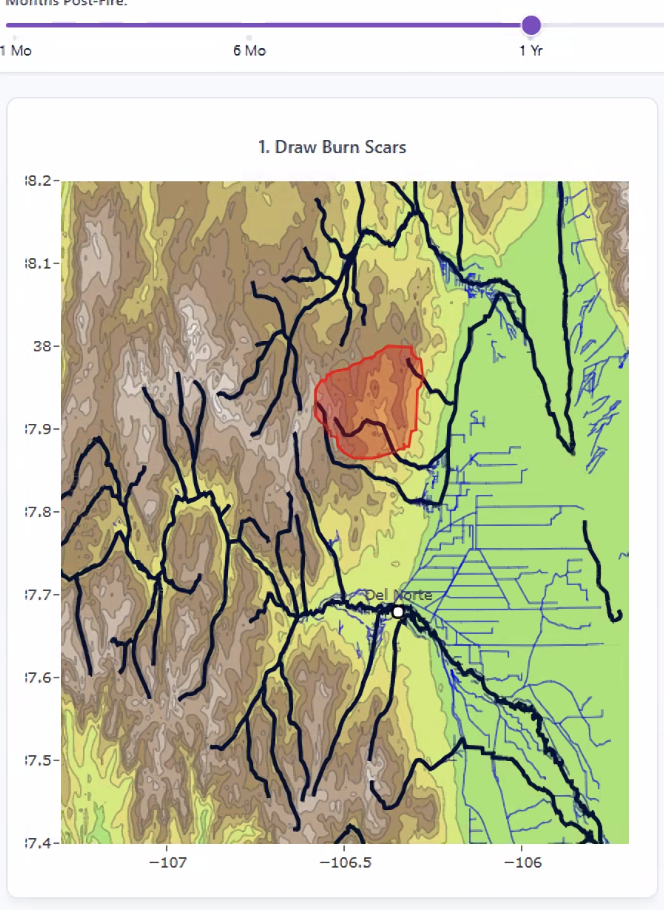
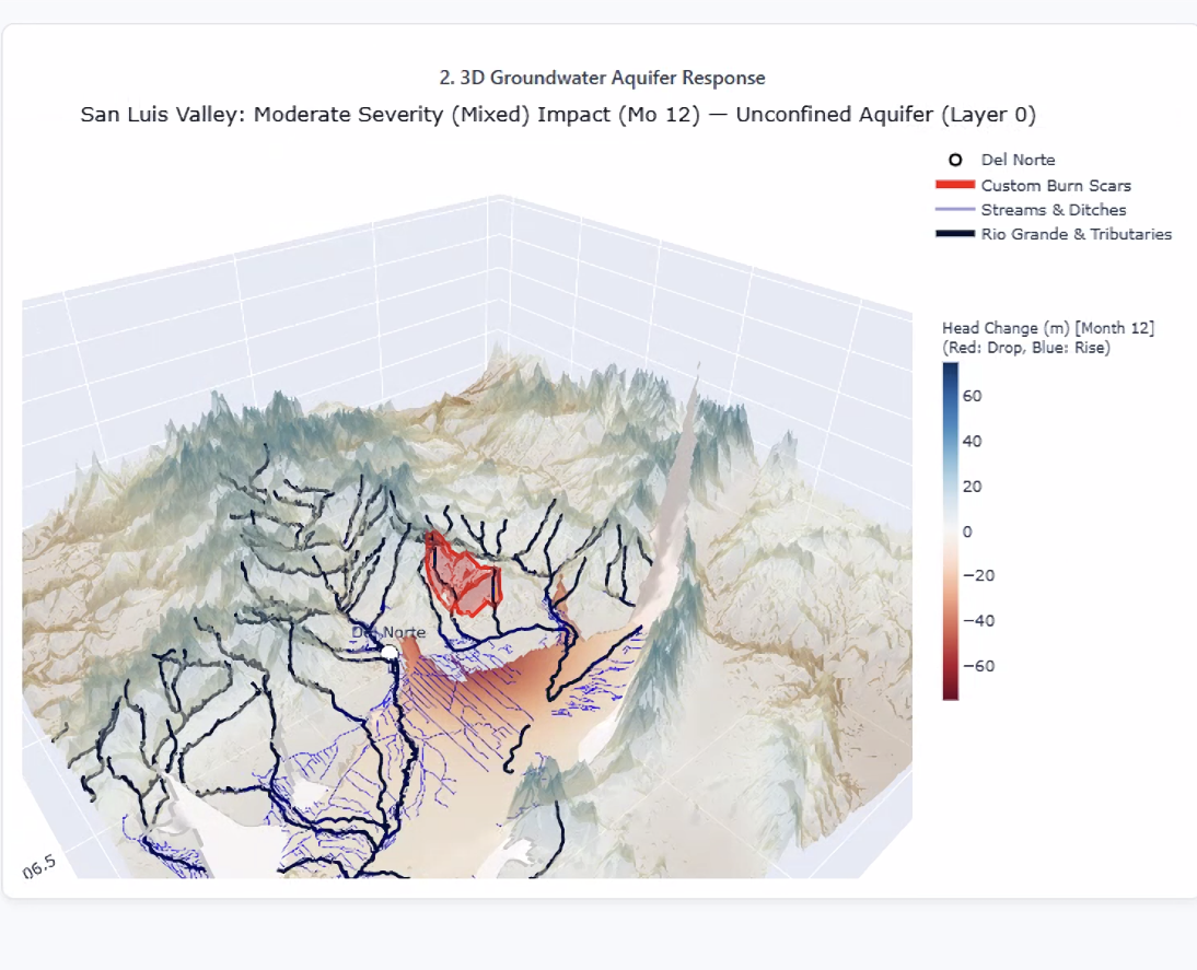
Scenario 1. A roughly 78,800-acre burn scar drawn in the upper drainage north of Del Norte. Modeled aquifer response one year after a moderate-severity fire north of Del Norte. The deepest drawdown (dark red) shows up downslope at the mountain-front recharge zone, not directly under the burn scar. Source: San Luis Valley Wildfire & Groundwater Simulator, Euwan Kim, Wright Ingraham Institute field workshop.
To make that risk easier to see, Kim built the San Luis Valley Wildfire & Groundwater Simulator, which pairs state groundwater data from the Rio Grande Decision Support System with user-drawn burn scars. The model was run on several scenarios in the drainages above Del Norte. This year the Aspen Acres fire burned over 100,000ac. If a fire of that size were to burn in Saguache County, the result would be a small dip in groundwater levels beneath the burn itself, and a much larger drop at the base of the mountains where water from those slopes would normally reach the aquifer. Even the smallest, lowest-severity fire would produce a noticeable decline within a year. The takeaway is that where a fire burns matters as much as how big it is.
Saguache County is exposed. Forest Service inventory data shows the Saguache Ranger District carries the heaviest salvage timber load on the Rio Grande National Forest: about 43,800 CCF of dead and dying timber across 17 salvage sales and roughly 5,500 acres.
The proposed La Garita Fire District, would be the closest responder to the forest that recharges the Valley’s aquifer. Right now the Sheriff aims to combine this effort with a Wildfire Brigade Unit that would serve all of Saguache County, and be able to respond to a fire before it grows to crown-fire intensity. The proposal is to establish a Saguache County Wildfire Brigade and La Garita Fire District. Saguache County is contributing a fire well, and now the initiative seeks funding for a building, equipment, trucks, etc. Beyond emergency response services, the district would also support fuels reduction on the upper-watershed slopes that feed the aquifer, and train local crews so they don’t have to wait on distant mutual aid.
Every season without dedicated local capacity leaves uninsured homes, forests and grazing allotments, and the aquifer our farmers rely on exposed. Investing in wildfire response in Saguache County is also an investment in the Valley’s water future.
Visit lagaritafire.org and get involved today.
